.png)
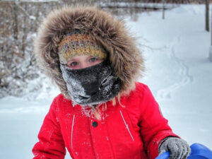
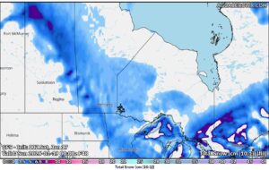
Blizzard warnings and blowing snow advisories remain in effect Sunday morning across much of southern and central Manitoba as strong northwest winds, falling temperatures and reduced visibility create hazardous travel conditions.
Environment Canada says the same weather system that moved in overnight will continue to impact the region through Sunday evening.
Winnipeg: blowing snow and extreme wind chills
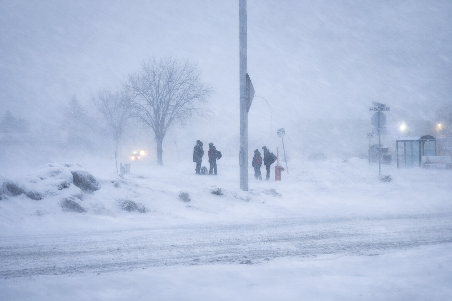
In Winnipeg, a blowing snow advisory remains in place after a few centimetres of snow fell overnight.
Periods of snow early Sunday have transitioned to flurries, with blowing snow expected to develop late in the morning and continue through the afternoon. Northwest winds are forecast to increase from 20 km/h to 40 km/h, gusting to 60 km/h.
Temperatures will sit near -15 in the morning before falling to around -22 by the afternoon. Wind chill values are expected to drop from near -24 early in the day to as low as -36 later in the afternoon, creating a significant risk of frostbite.
Conditions improve Sunday evening as winds ease. Skies are expected to be partly cloudy overnight with a low near -23 and a wind chill near -34.
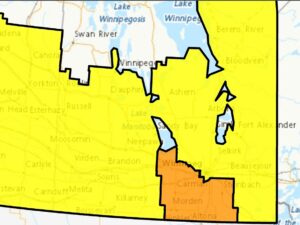
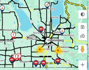
Blizzard warnings for Pembina Valley, Eastman, and Central Plains
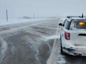
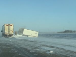
Blizzard warnings remain in effect for much of southern Manitoba, including the Red River Valley and areas south and west of Winnipeg.
Communities such as Steinbach, Winkler, Morden, Altona, Niverville and Portage la Prairie are expected to see northwest winds of 50 km/h, gusting up to 80 km/h throughout the day. Those winds will combine with snow to produce near-zero visibility at times.
Daytime temperatures will fall to around -22, with wind chills ranging from near -29 in the morning to as low as -37 in the afternoon. Frostbite can occur quickly in these conditions.
Travel is not recommended in blizzard warning areas, as whiteout conditions may develop rapidly and road closures are possible.
Brandon and Westman region
In Brandon and the Westman region, cloudy skies with a 60 per cent chance of flurries are expected in the morning, followed by local blowing snow.
North winds near 40 km/h, gusting to 60 km/h, will gradually ease and shift northwest around midday. Temperatures will reach about -12 before falling to near -19 in the afternoon. Wind chill values are expected to drop to around -29.
Travel and safety reminders
Environment Canada continues to advise postponing non-essential travel where possible. Drivers who must be on the roads should slow down, turn on headlights and be prepared for sudden drops in visibility.
Full weather details, including current conditions and weather radar, are available on the Jani-King Weather Page.
Stream CHVN or tune in at 95.1 FM for the latest weather and highway updates.
If you have a tip, email dj@chvnradio.com or contact the Shine Dental Talk & Text Line at 1.877.951.2486.