A significant winter storm system is headed for southern Manitoba, bringing the potential for heavy snowfall and poor travel conditions early in the week, and a return to winter-like temperatures later in the week.
Environment Canada issued a special weather statement Sunday night covering all of southern Manitoba and extending into much of Saskatchewan and Alberta.
The alert warns that a strong low pressure system will move into the region beginning Tuesday evening and persist into Thursday morning.
Heavy snow and possible freezing rain

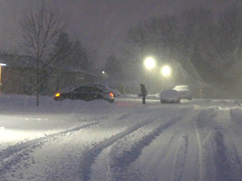
Environment Canada says 15 to 25 centimetres of snow is possible in many areas, with visibility reduced at times in falling and blowing snow.
Freezing rain cannot be ruled out, especially across parts of extreme southwestern Manitoba and neighbouring regions, as temperatures hover near the freezing mark Tuesday and Wednesday.
The system is expected to begin early Tuesday evening and taper off overnight into Thursday morning, with the worst conditions likely on Wednesday and Thursday.
Travel conditions expected to deteriorate
Motorists should prepare for deteriorating travel conditions through mid-week as accumulating snow and strong winds create slippery roads and reduced visibility across much of the region, according to the weather statement.
In the wake of the system, much colder, winter-like temperatures are forecast to return to Manitoba and nearby areas.
By Thursday night the overnight lows are expected to be near -20, and daytime highs Friday and into the weekend will range from -14 to -16.
Full weather details are available on the Jani-King Weather Page.